

Full report - August Hiking Adventure in the Sarek Wilderness
May your inner tent always stay dry.
The last time I reported on a long hike, I started with this:
It’s 2023, I’m 47. The last time I walked that much and that hard for six days in a row I was 25.
It’s 2025 now and I just turned 49, but the last time I walked that kind of distance was two years ago; the last time I was on the trail for that long was never!
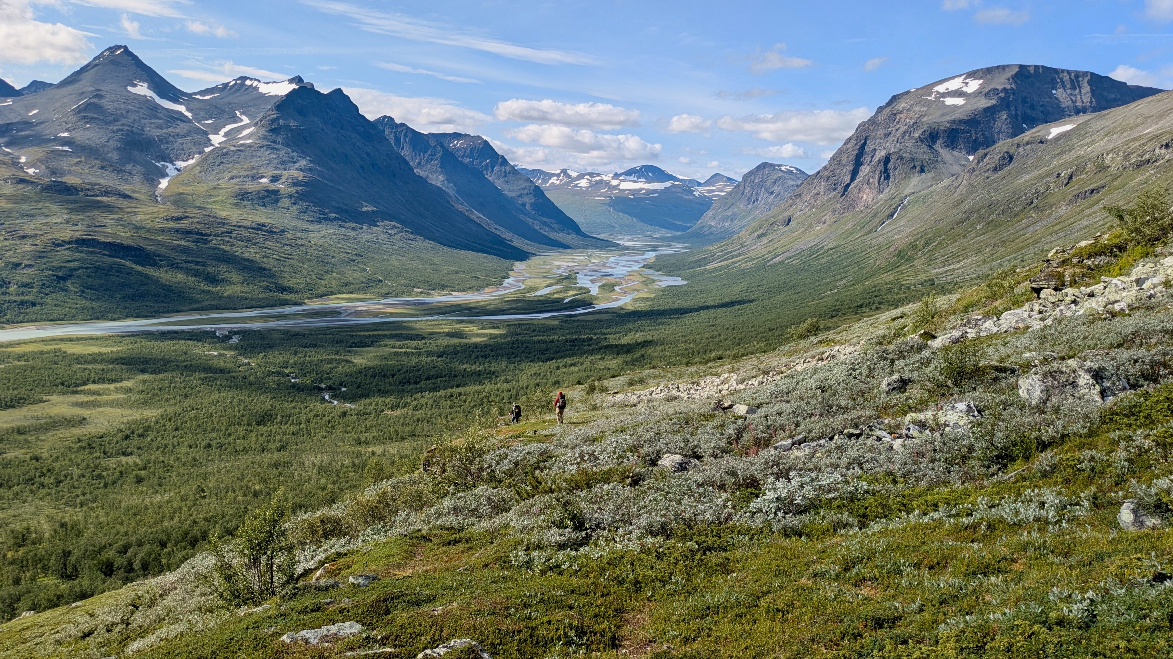
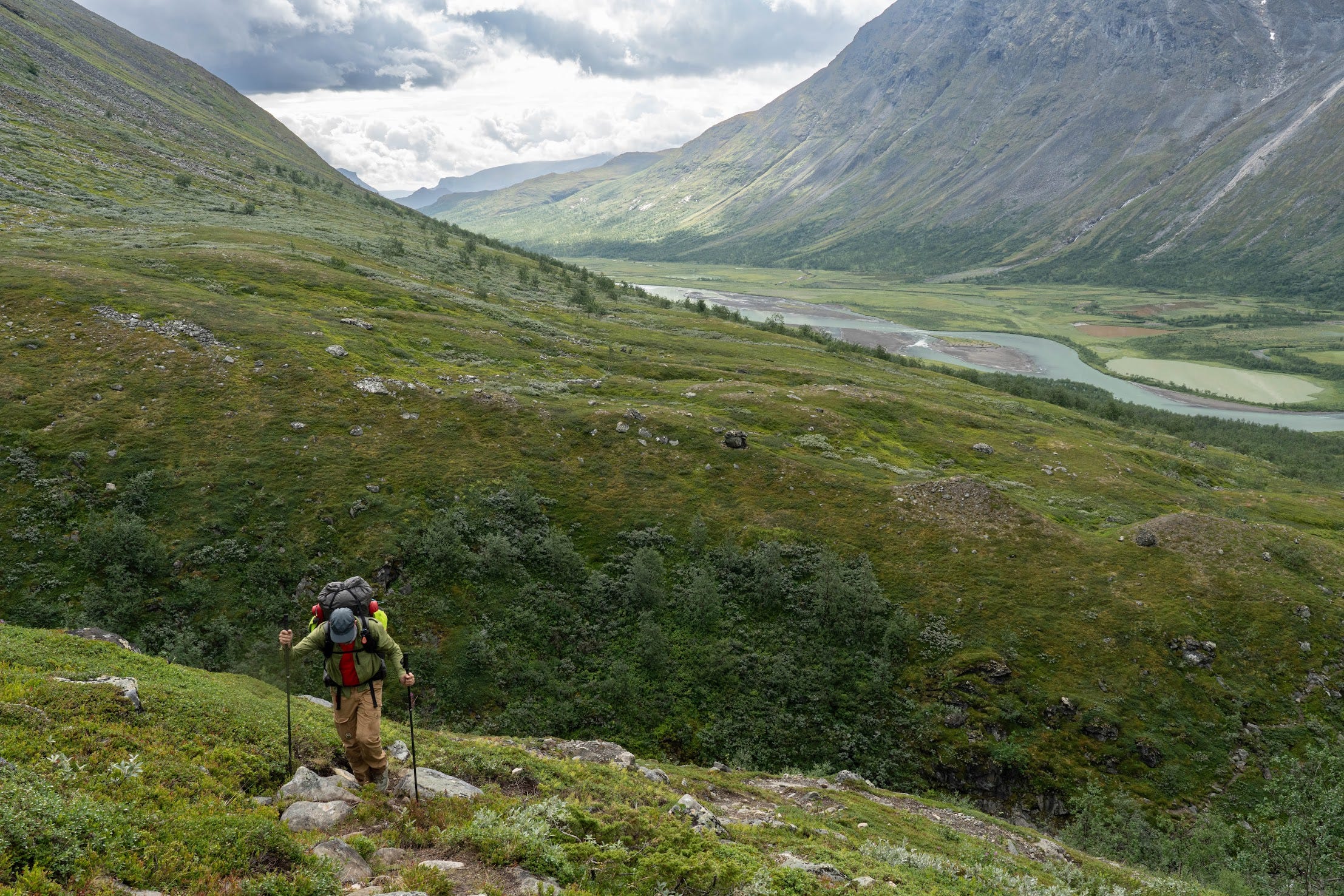
Let me just say this first: The Sarek National Park in Swedish Lapland is absolutely stunning, drop-dead gorgeous. Glorious!
For those who don’t necessarily want to read the report but are interested in the picture highlights I’m going to start with a couple of highlight galleries this time.


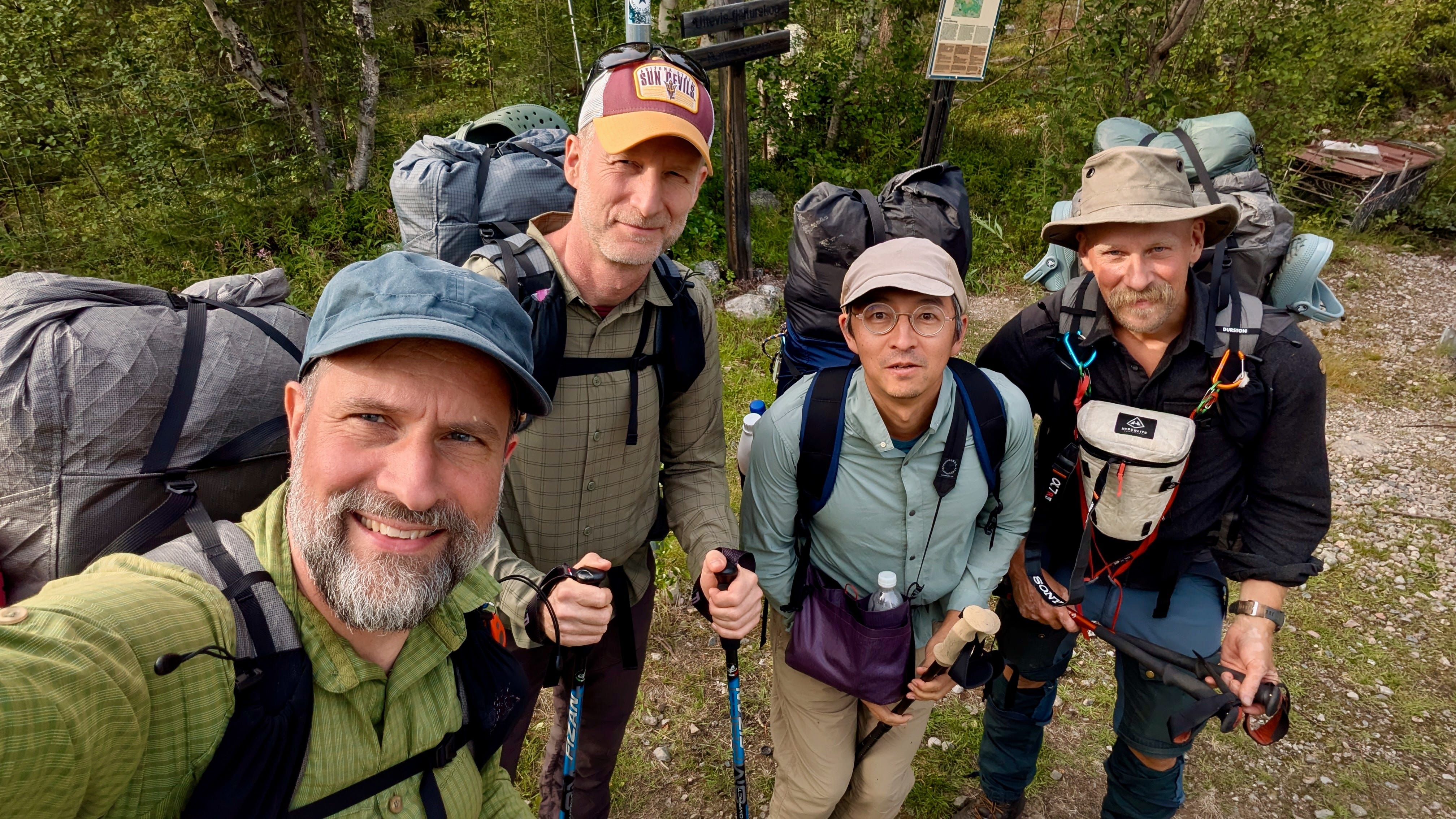
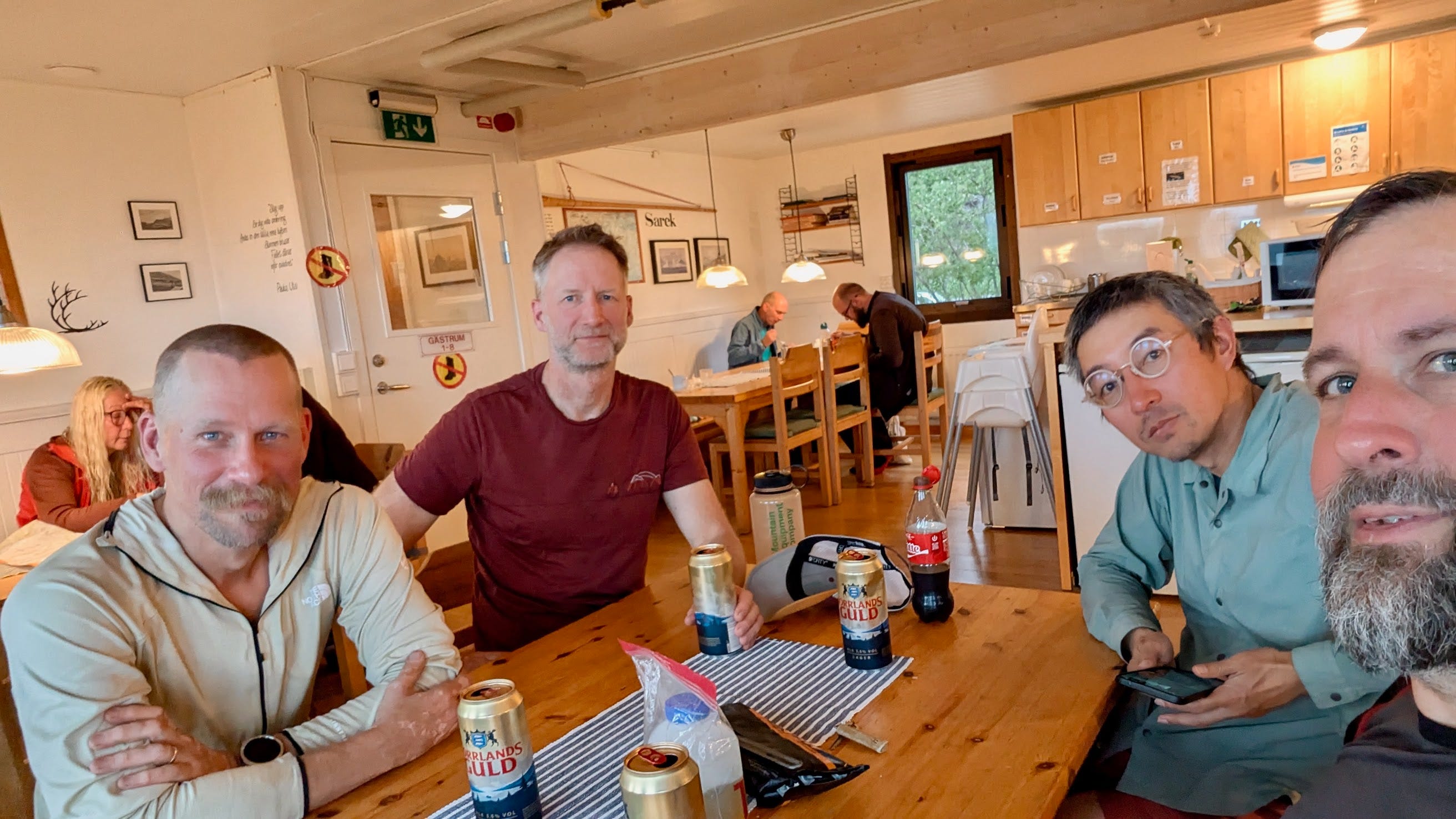
The company
Who you’re hiking with matters. And again, I had the pleasure of hiking with a group of men who all inspired me in different ways, guys with interesting and sophisticated perspectives on a wide range of topics, and people I quickly knew I could trust in the wilderness.
Henrik
Henrik, our inclusive, cheerful and extremely well prepared Swedish native expedition leader. He was the one who came up with the plan and pitched it to Michiru. He had studied all the maps and knew half of them by heart. He had memorised the names of peaks, glaciers and rivers and new where to ford the latter as well as where to pitch the tents. He is also a machine who could have carried me through the friggin’ Sarek if it had been necessary.
Michiru
My long-time trusted hiking buddy, who always makes me calm with his stoic nature and then makes me nervous again with his experimental, almost contrarian, sometimes borderline risky equipment choices. An assessment he doesn’t fully agree with. It’s hard to imagine doing any bigger hiking adventures without him. I highly appreciate his lectures and our discussions about various topics in the broad areas of economics, coffee, ultralight equipment, sustainability or general philosophy of science. He’s a great teacher with the natural talent of adapting to different levels of pre-existing knowledge. Hours of walking can pass without noticing, when the right topic comes up.
Kelvin
Our Canadian. Why does that matter? Well, Canada is one giant epic landscape, yet Kelvin flew all the way to Europe for this hike. That says something about the reputation of the Sarek as well as Kelvin’s adventure spirit. He is an adaptable team player. He can stay in the background or take the lead, it doesn’t matter to him. He does everything in a calm, observant, well measured way and that includes drying the trousers he’s wearing with his hot food packages while the food soaks. He brought a chair to the hike but his pack was still lighter than mine.
Good old me
Fitter than two years before, but still not fit enough for the adventure at hand, instead equipped with pain killers of various increasing strength. I shall leave it to others to describe me as a hiking companion. I know one thing, I’m in constant awe in a place like Sarek and I talk about it.
Our packs and gear
This time, there was no food restocking for 8-9 days. That meant a lot more weight in food than ever before.
My pack — example of ultralight geared towards comfort
I took WAY too much food. I could have left 2kg of food behind and probably avoided some of the knee pain. But I learned a lot about food planning for longer hikes. My calorie-to-weight ratio and overall nutritional balance were good, but I was too afraid of a larger caloric deficit. It’s totally okay to run a deficit of 1,000 or more calories per day.
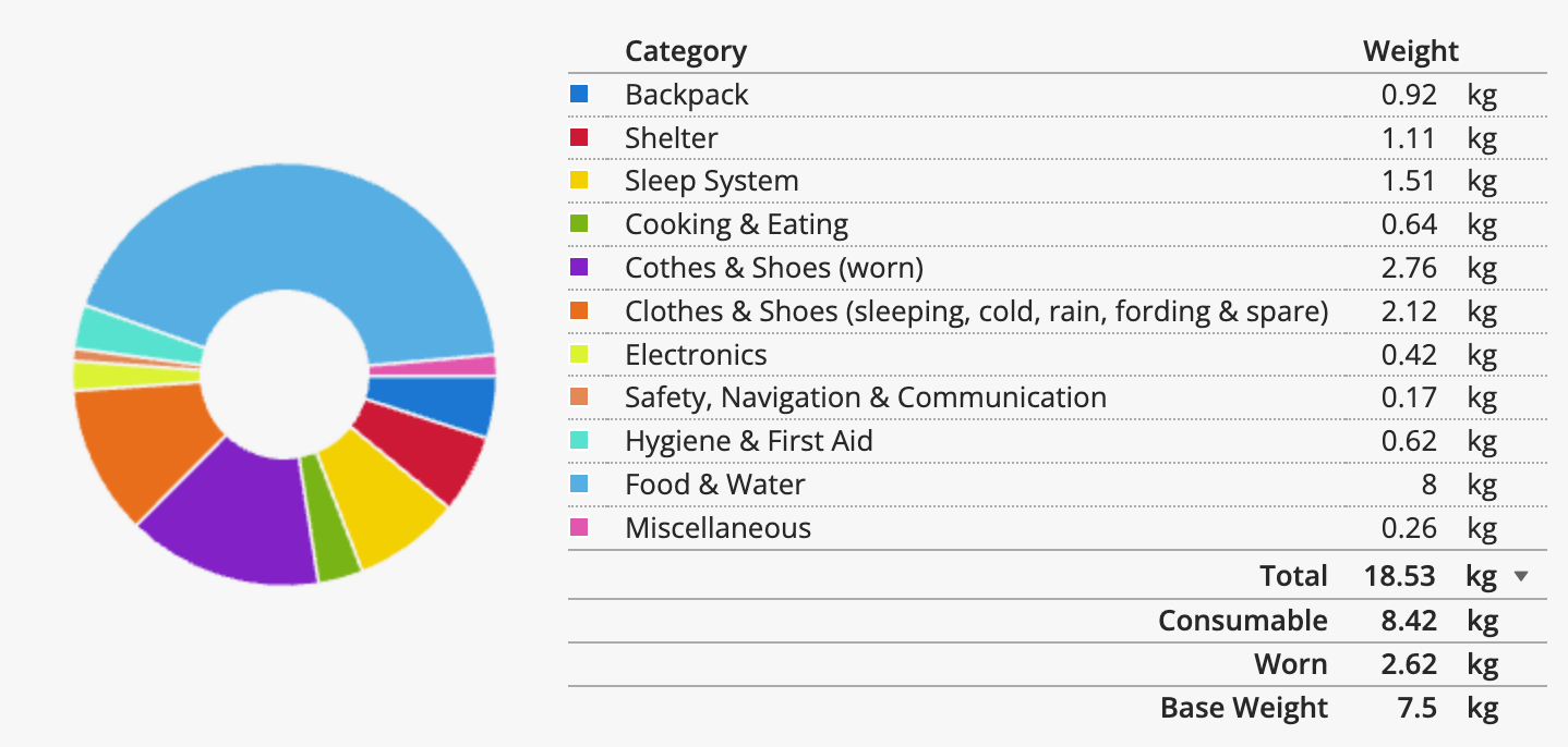
You can see my exact gear list on LighterPack.
Michiru’s pack — example of minimalistic ultralight
As usual, Michiru’s gear ist mind-bogglingly light.
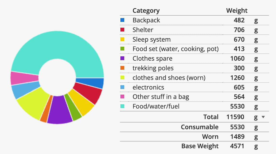
You can see Michiru’s full gear list on LighterPack too.
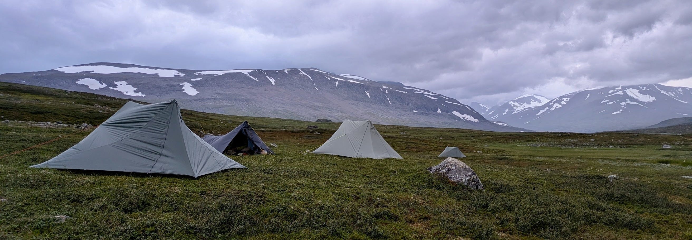
Shelter
It was pretty much a Durston X-mid convention plus Michiru’s tarp. The X-mid is a great trekking pole tent that I’m not so easily going to switch out, especially now that I exchanged the lines with thicker, more storm-worthy ones. The only tents I would replace this with are some Hilleberg tents and I can’t afford these. Kelvin had an X-mid 2 and I think while the genius of the X-mid architecture works really well for the one person tent, it kind of already gets to its limit with the 2 person version. Getting it pitched nicely in windy conditions is maybe a little bit more challenging than you’d want it to be when it’s cold and wet.
Cooking & Food
On this trip I wanted to have the possibility to go solo if necessary (mainly if I felt I was holding everyone else back too much). So I knew early on that I was going to have a one person tent as well as my own cooking gear and menu. I went with the lightest possible gas stove, the BRS 3000T. It’s not very efficient in windy conditions but when you can cook in your tent vestibule, that’s not an issue.
This time I tested several brands of dehydrated food which I had never used before and was very happy with the Estonian brand Meki, which offers great calories/weight ratio and taste for affordable prices. For the future I would take dehydrated meals even for shorter trips. They are light, pack small and need relatively little gas.
The itinerary
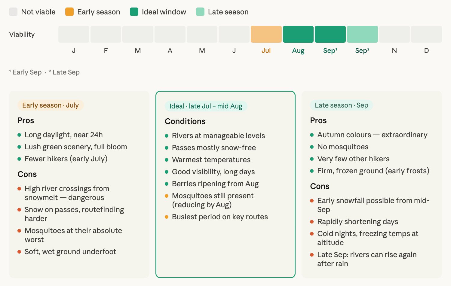
Timing
We were on our feet from the 11th of August until the 19th. The middle of August is in many ways an ideal time for a Sarek adventure.
Approach
The Sarek is a remote national park which is not as accessible as other hiking regions in Swedish Lapland. My approach took me two days:
Ferry Tallinn-Stockholm
Night train Stockholm-Galliväre
Bus Galliväre-Tjåmotis (roughly)
Local taxi man Jens from Tjåmotis to an entry point at the end of the road
The route
We walked the perfect introduction route to the Sarek, the classic main route of about 110km from Aktse to Akka with elevation changes of about 4000m where you encounter other hikers and there are emerging paths to quite some extent.
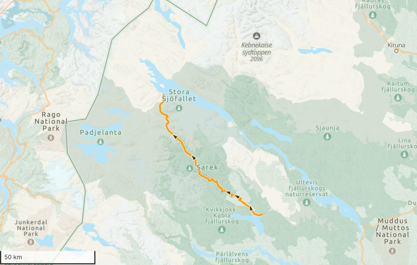
The beginning and end of the route have huts, the Sarek itself doesn’t have any infrastructure with a few noteworthy exceptions.
Glossary
Reading maps in Sami territory is a fun challenge, it helps to learn some (norther) Sami words for that. Here are some examples, more for the sake of appreciation for the beauty of this archaic language than anything else.
jávrre (lake, Estonians will see the relationship to järv)
jåhkå (river, Estonian: jõgi)
luoppal (widening)
vágge (valley)
várre (mountain)
tjahkka (peak)
gájsse (cone peak)
roavve (ridge)
vallda (slope)
jiegŋa (glacier/ice, Estonian: jää)
Day 1: Trailhead to Aktse (16km)
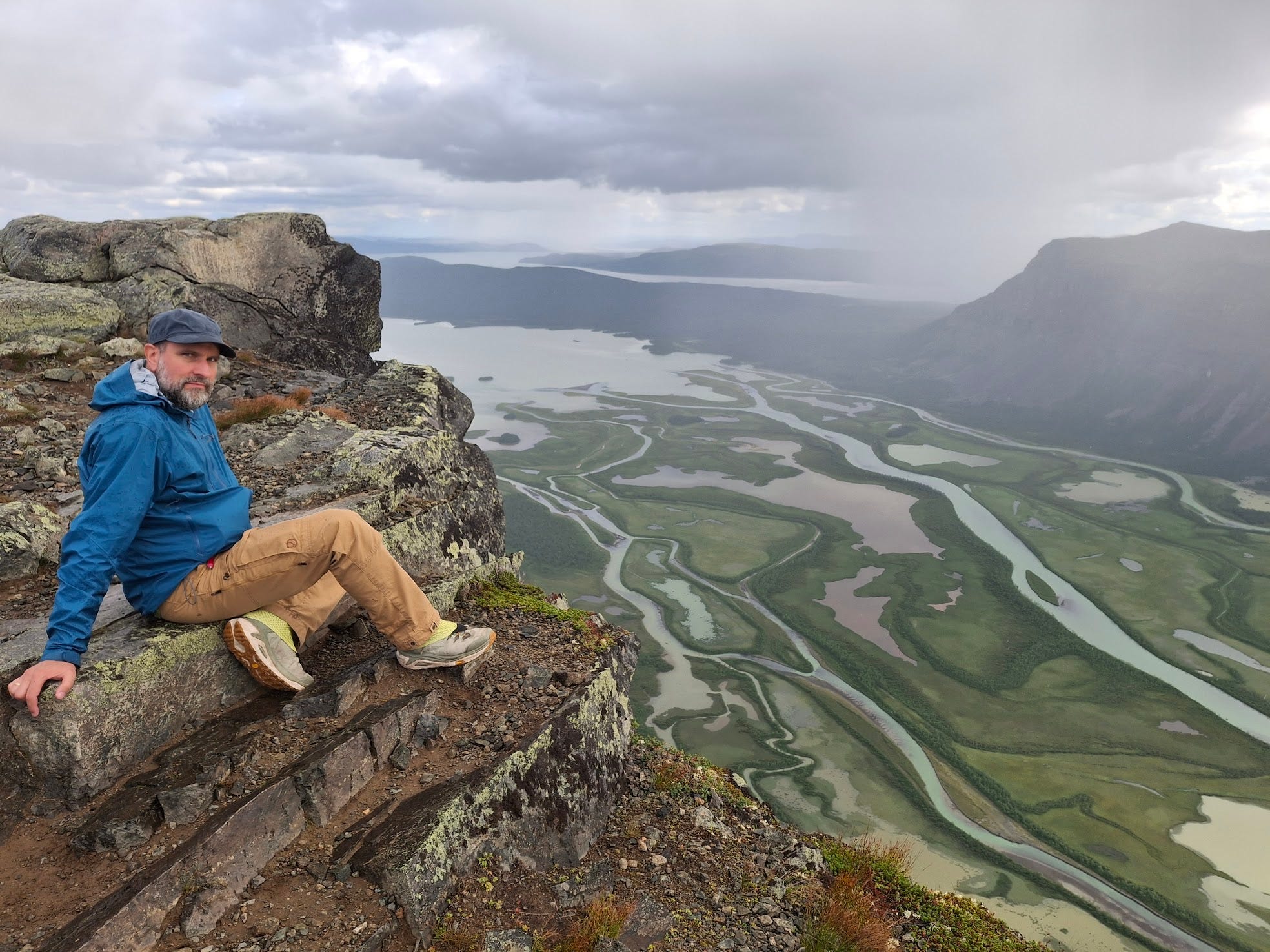
Day one offers a walk on an easy path from the end of the road near Tjåmotis to Aktse Fjällstuga. This STF hut is located just outside of the border of Sarek and offers the first great views of the mighty Skjerfe cliff. The pack is heavy and the body unadjusted. This stretch feels longer than it is, but the view on arrival is both a great reward and a promise.
The hike from the hut to Skjerfe and back is something I highly recommend to anyone who wants to see the beauty of the Sarek while staying near the huts. It’s a full day adventure that offers some of the most epic views of the whole region. Overlooking Rapa valley from the edge of Skjerfe is truly awe inspiring.
The first night, Michiru and I stay in the hut as I have to justify my STF membership and want to enjoy the relative comfort and nostalgia of hut life while I still can.
Day 2: Aktse - Skjerfe - Ridok (17km)
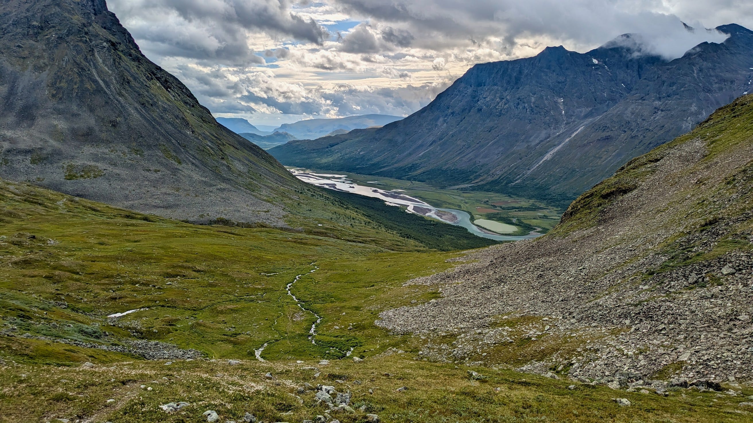
The second day takes us up to the Skjerfe cliff where we enjoy the jaw-dropping views for a good while, before moving on into the Sarek on the high route across a boggy plane up a steep bouldery flank over a ridge towards our camp site behind Ridok mountain with a view back on Skierfe and the Rapa Valley.
We walk a bit over 17km that day with quite some elevation in the mix and a still heavy backpack.
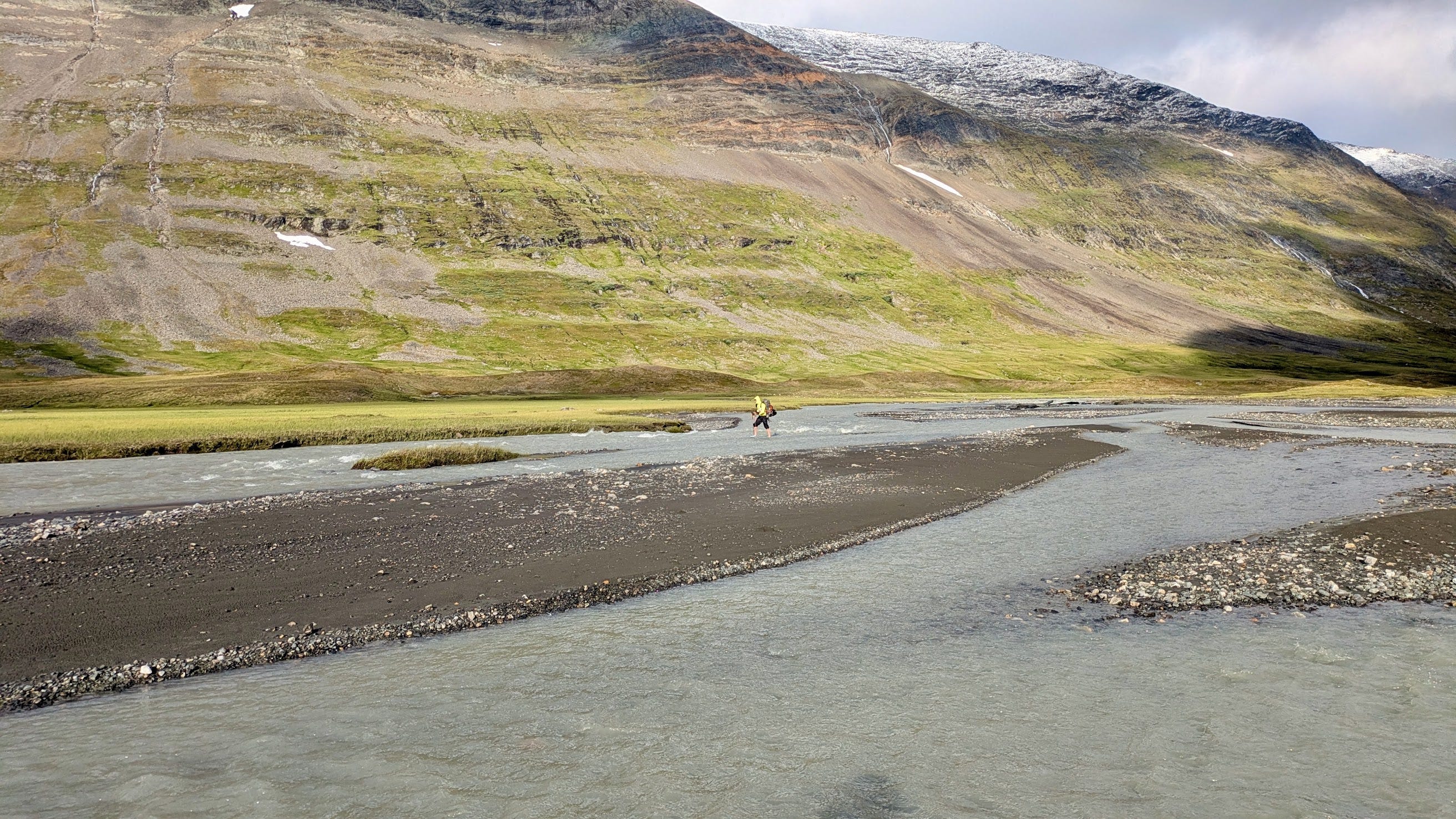
Day 3: Ridok - Ráhpavágge - Skårkistugan (19km)
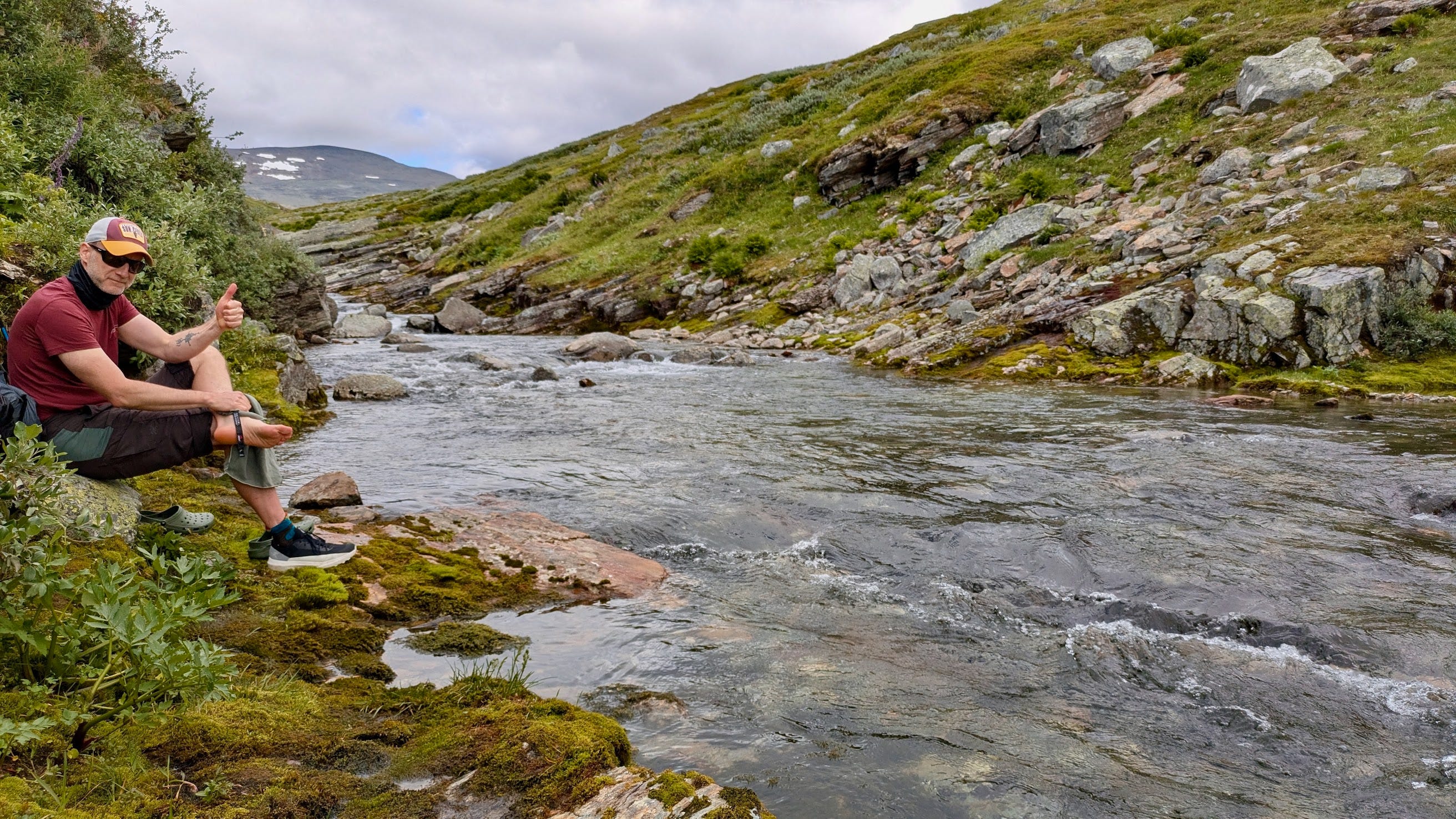
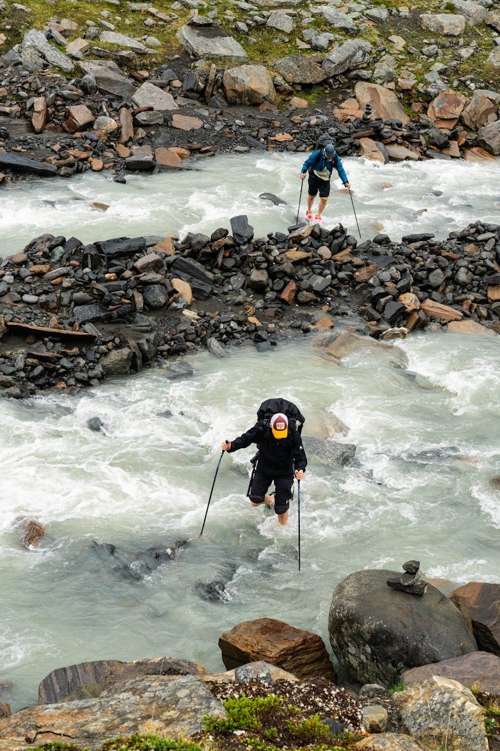
The hardest hike of the journey with just over 19km, some river crossings, a relatively steep decline down into the Rapa valley and an exhausting 10km walk along the Rapa river. The exhausting part is the crossing of countless small tributary river mouths where you either have to change shoes, get really wet, or jump (with 17kg on your back). In combination with the distance it really tires me out. It is supposedly still a lot better than the upper path which leads through the infamous bug ridden willow shrubs and consists of a whole lot of bushwhacking as we hear from other hikers and know from written reports.
In terms of scenery it is a very diverse stretch with alpine landscapes, glacier views, a steep descent along a Rapa tributary through a lovely birch forest and summer flowers in bloom. Then a close encounter with the bottom of the Rapa valley and the river’s silvery-blue waters.
The original plan had been to walk on and regain altitude towards Lådepakte, but to my great relief the others suggest we pitch our tents near Skårkistugan at the bottom of the valley. Skårkistugan is a locked up former research station that can’t be used as shelter, but there are some good tenting spots close by.
The night near the research station is our only chance to meet the famous Sarek mosquitoes but as we make a camp fire that night and Henrik (now being a proud new NATO member) erects an iron dome of mosquito defence around our camp site, we’re mostly spared the pleasure of this Sarek specialty.
Day 4: Skårkistugan - Snávvávágge - Bjelavallda (14km)
After breakfast we leave the valley floor and tackle the 450 meters of ascent to the Snávvávágge, the high valley that lets us avoid 10km of bugs and bushwhacking hell down in the Rapa valley.
Henrik takes off to scale the peak of Låddebákte (1538m) while we walk the length of the valley with the goal to get the day’s crux done before wind and rain arrive. The crux being a steep and rocky traverse connecting the Snávvávágge to the Bjelavallda. The traverse is exhausting but less exposed than expected and sturdy bushes give extra holds for the hands as well as protection.
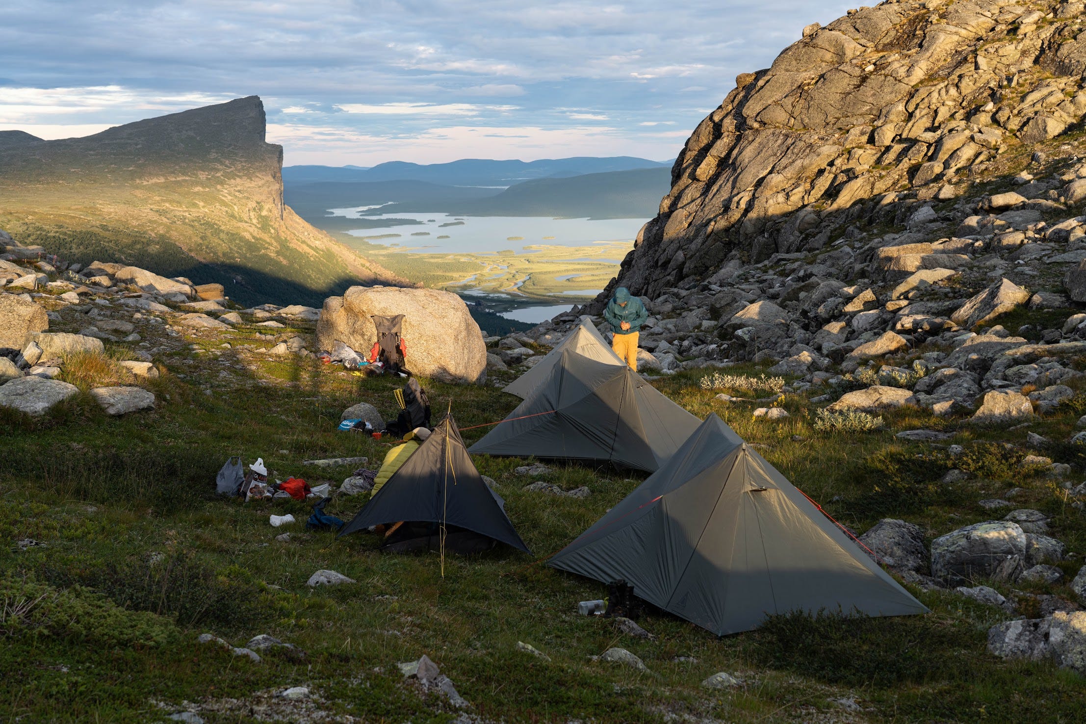
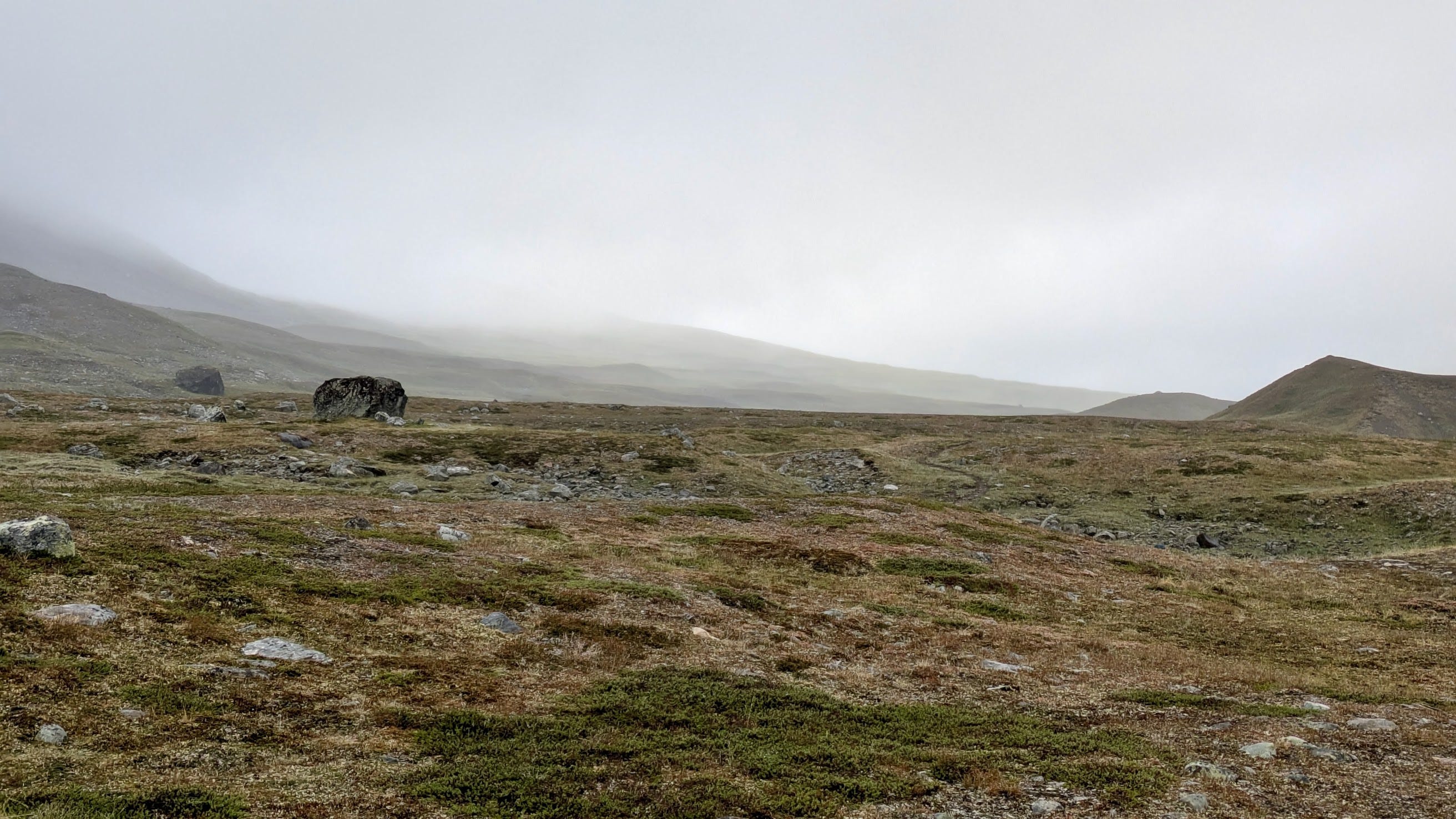
The travers flattens out and we keep the altitude until we reach the flat and wide northern slope (vallda) of the Bjela mountain. It starts raining and we’re tired, the only almost-conflict of the hike occurs (everything descends into anarchy without Henrik) and we pitch our tents in the middle of the slope, making it hard for Henrik to find us later that night. The camp site is surrounded by imposing mountain massives on all sides. We’re very far away from human civilisation now and with the wind and rain picking up, I feel a bit of that naked exposure to nature and the elements that I’m simultaneously looking for and dreading.
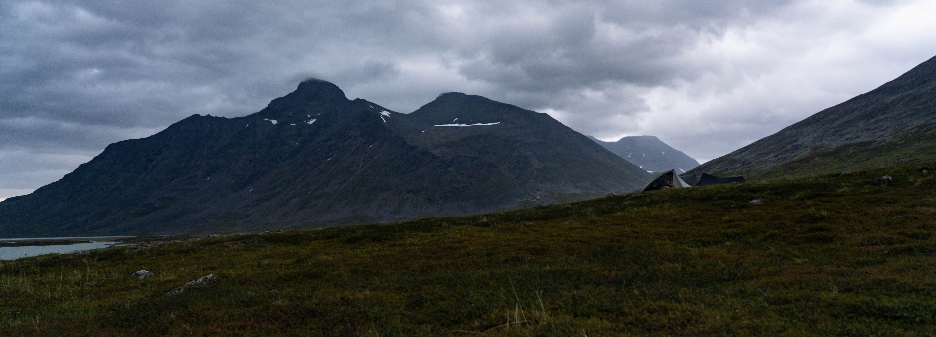
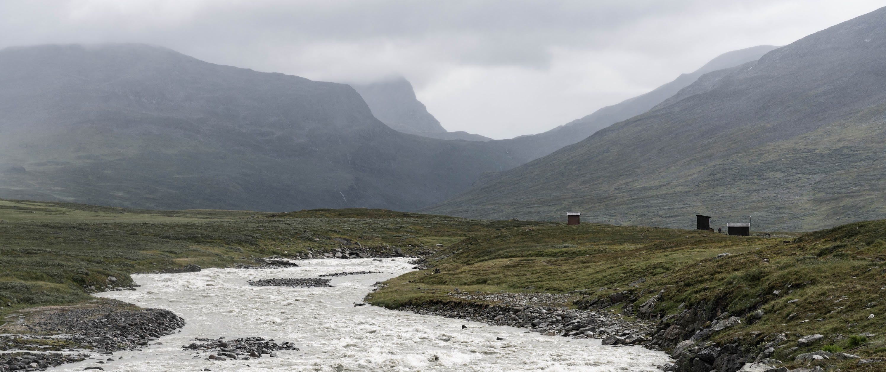
Day 5: Bjelavallda to Skárjá (9km, rest day)
The rainy and windy weather as well as a storm forecast make the decision simple. We take a rest day and only walk the relatively easy stretch to the Skárjá emergency hut. Skárjá is the one place with infrastructure in the Sarek, there is a bridge over the mighty, roaring Smájllájåhkå, the hut and an outhouse. The hut is very small and badly insulated. All it contains is an emergency phone, some benches and a table. It gets overcrowded with more than 4 people in it and yet, the feeling of added safety in the imminence of the approaching storm is undeniable.
As a matter of fact, the next morning we would find a thoroughly soaked and miserable guy in the hut, who’s tent had blown off the ground during the night and failing to find his pegs and re-pitch his tent in the storm had then walked for 7km through darkness, rain and heavy winds to take shelter in the hut.
The night turns out as expected, heavy rain and storm gusts testing the tent and pitch to the limit, it’s 5° in the tent and the feeling of vulnerability is strong, the answer to the question “How did you sleep?” the next morning is “Many times.”.
Day 6: Skárjá through Ruohtesvágge (14km)
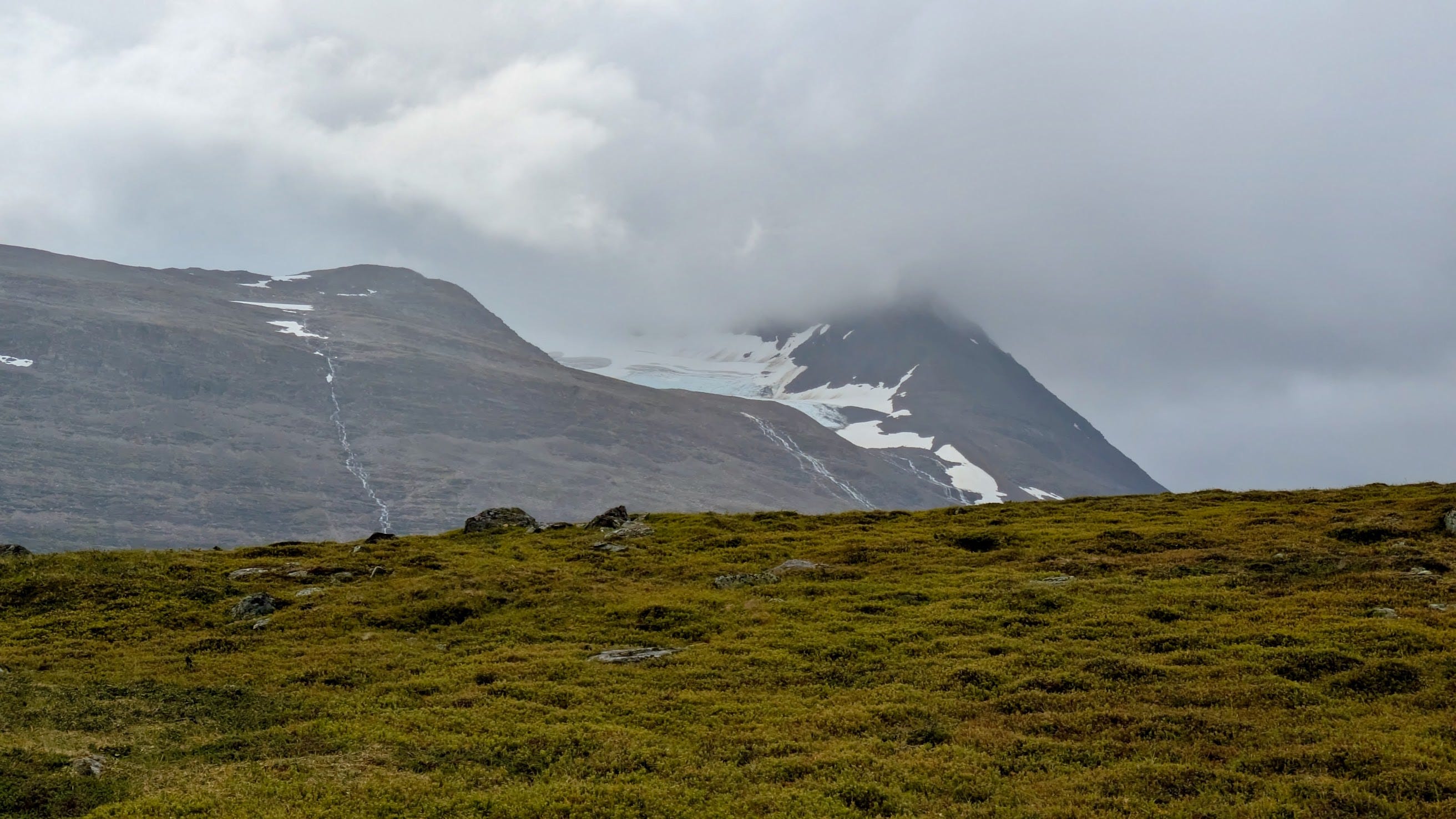
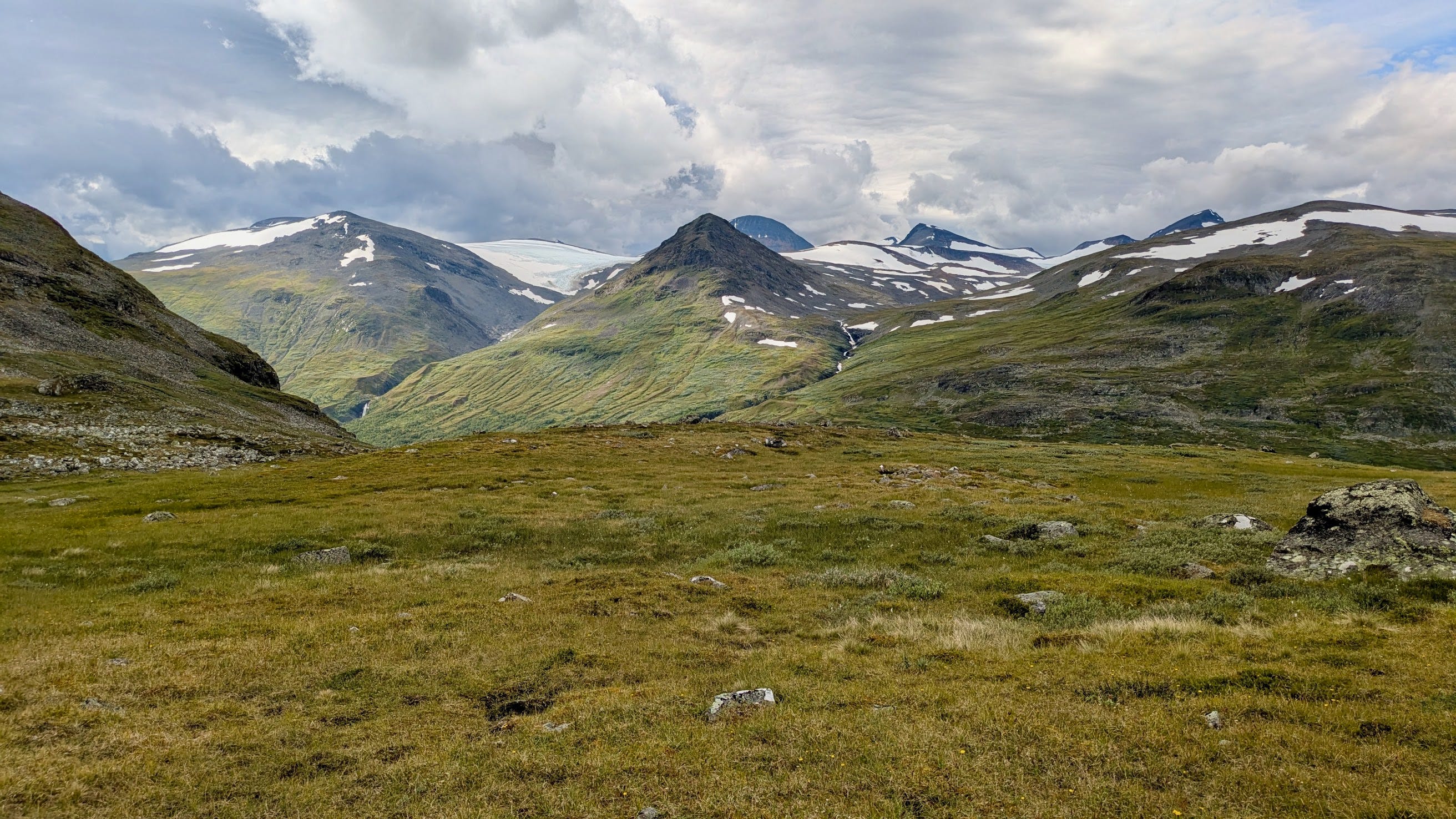
We wait out the worst of the weather and leave Skárjá around noon. We now enter the stunning Ruohtesvágge, a long as well as wide ancient glacier valley that offers views on a number of the Sarek’s ~100 glaciers.
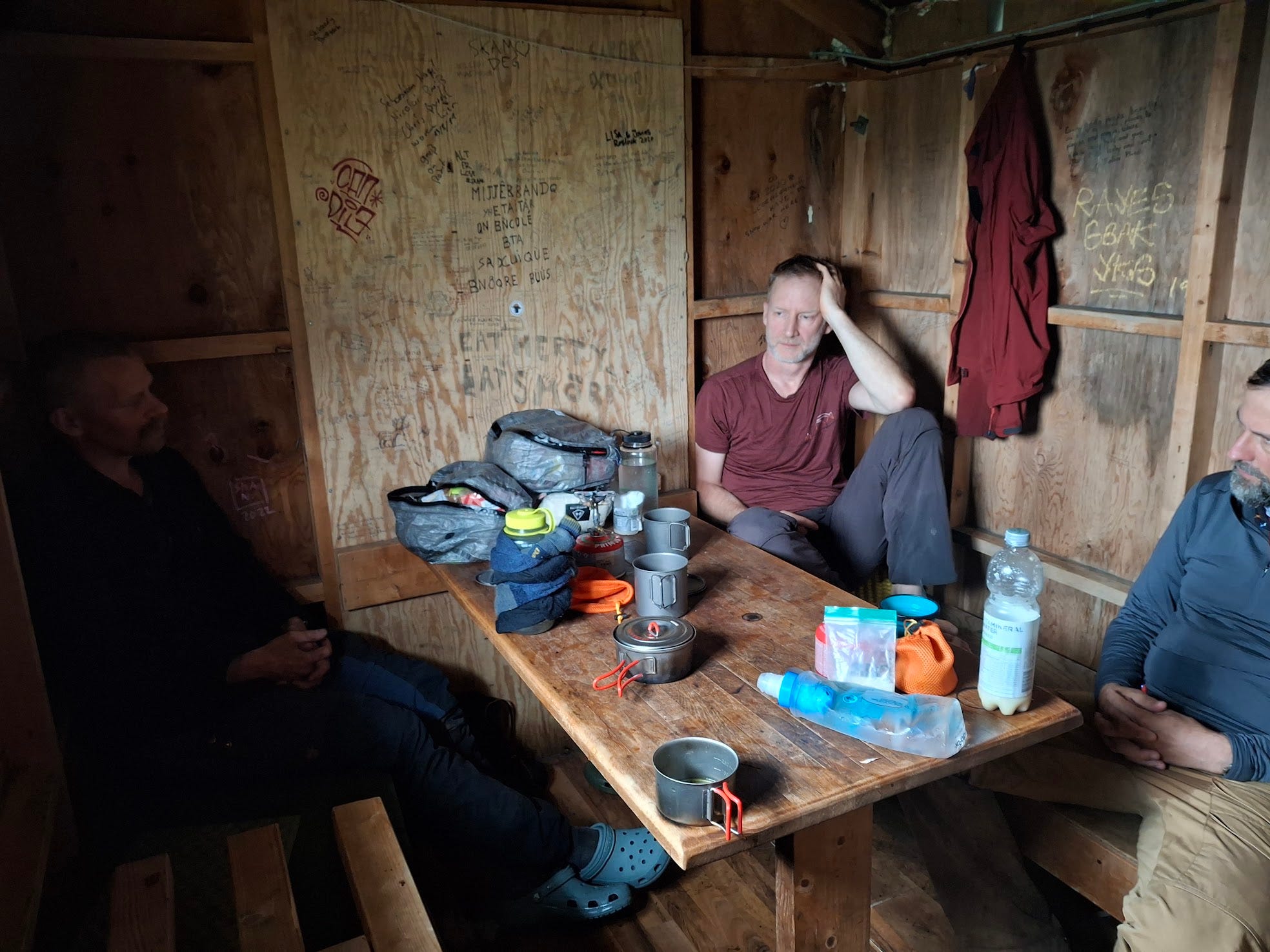
This stretch contains some river crossings including the most challenging fording of the trip where we have to cross the Smájllájåhkå to its north-eastern bank in order to continue up Ruohtesvágge. It’s one of the fordings that - upon completion - warrants a high-five or some other form of celebration like a good Swiss yodel. We continue until the ruins of an abandoned hut that is marked on the map as Renvaktarstuga (Swedish for reindeer watching hut). Several structures are marked as such in the valley, this one is located on a little hill just about 1km from Ruohtesjávrasj (a little lake named after the Ruohte massiv that gives its name to the valley too).
We pitch our tents and meet up in the ruin for jokes and maintenance. The atmosphere is relaxed as we share a feeling of having escaped the jaws of Sarek unscathed. Everyone attempts to dry their gear as best as they can, innovative concepts such as crotch socks, drying your trousers with your food or drying socks with boiled water in Nalgene bottles are discussed. Henrik uses soap water to find a whole in his sleeping mat while the rest of us eat. Even as I cook a double portion of food in the general hybris, already a slight touch of nostalgia and loss mixes with the elation. Had I been challenged enough? We were still far from our final destination, but in some ways, the trip felt over that night, the rest of it was enjoyable de-proach.
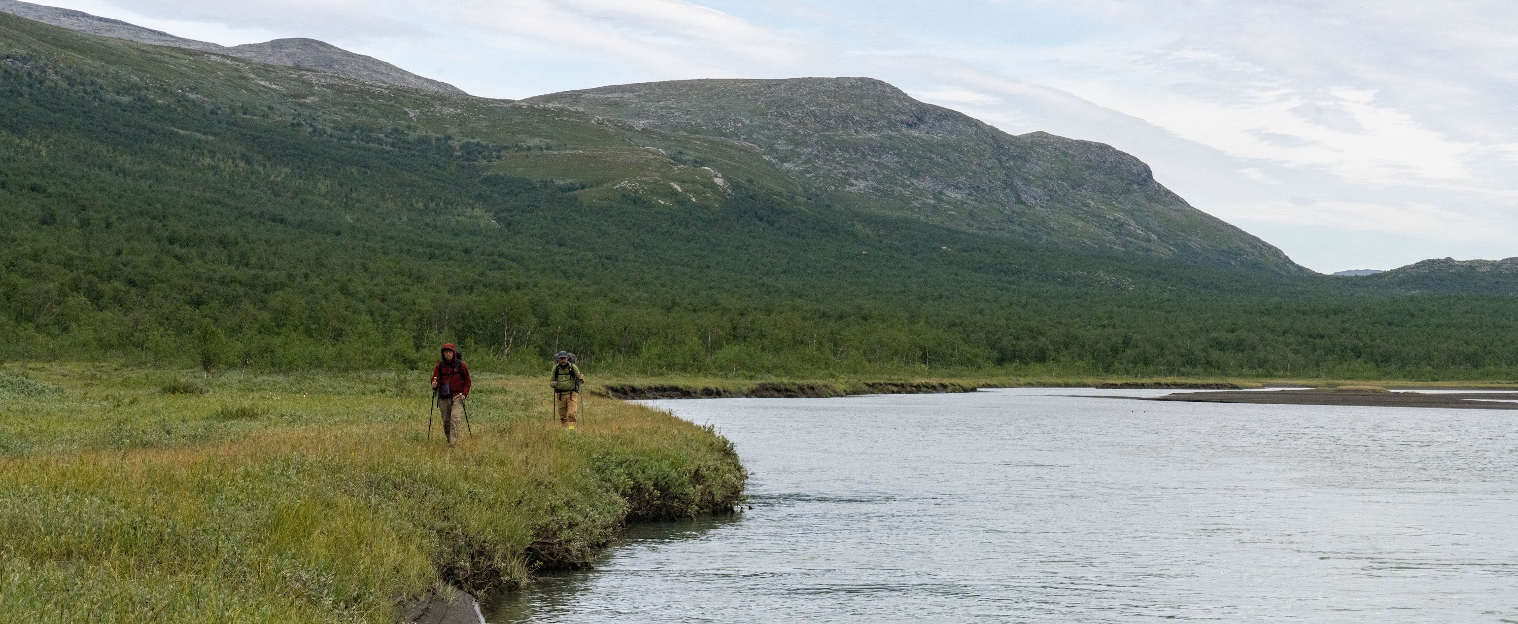
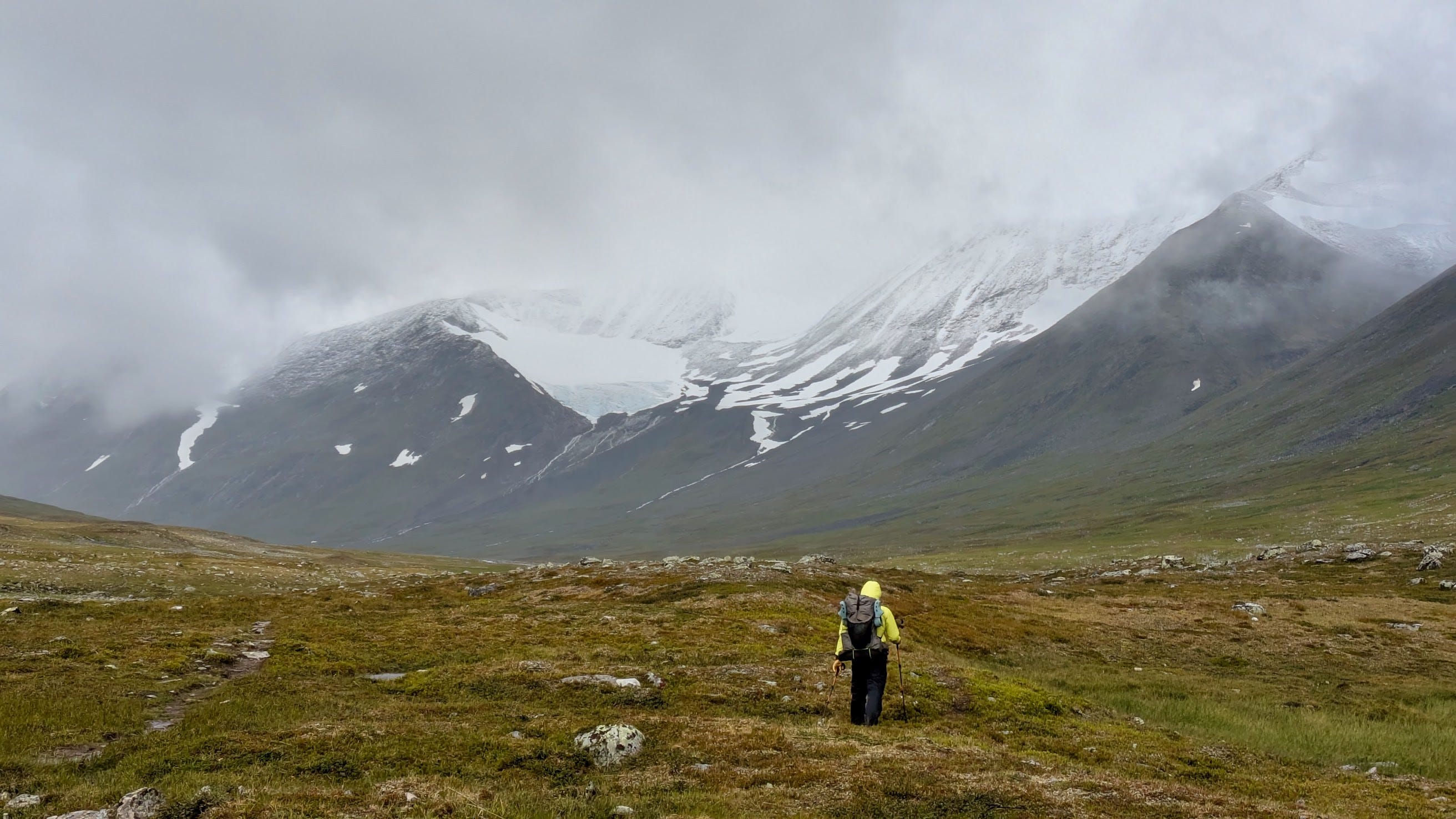
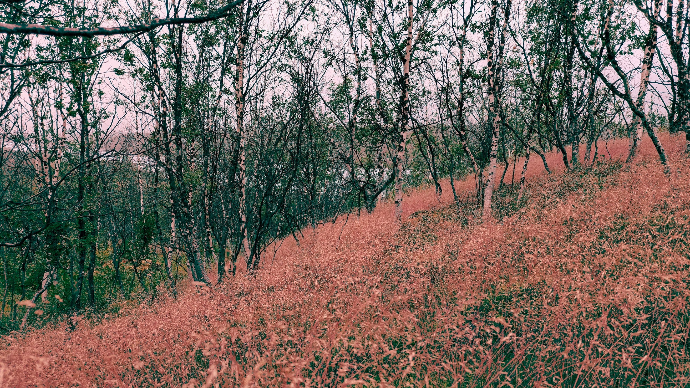
Day 7: Ruohtesvágge to Gisuris (20km)
The longest distance on the whole trek, but the path is easy, the body adjusted and the packs relatively light. The clouds are still hanging low and we miss some of the potentially stunning glacier views especially towards Áhkká, the mother mountain. Yet the Ruohtesvágge is a mighty valley and doesn’t fail to impress either way. The landscape changes, the first birch trees start appearing as we approach the Gisuris hut that sits on the Padjelanta trail. To my disappointment, this is not an STF hut and payments can only be made in cash to a person with an uneven face and a barking dog. I should have pitched a tent like Kelvin and Hendrik but it is good for the group to have a tea tasting in the common room of the hut. We try all three of Michiru’s remaining teas that night and eat black chocolate in candle light.
Day 8: Gisuris to Akkastugorna (14km)
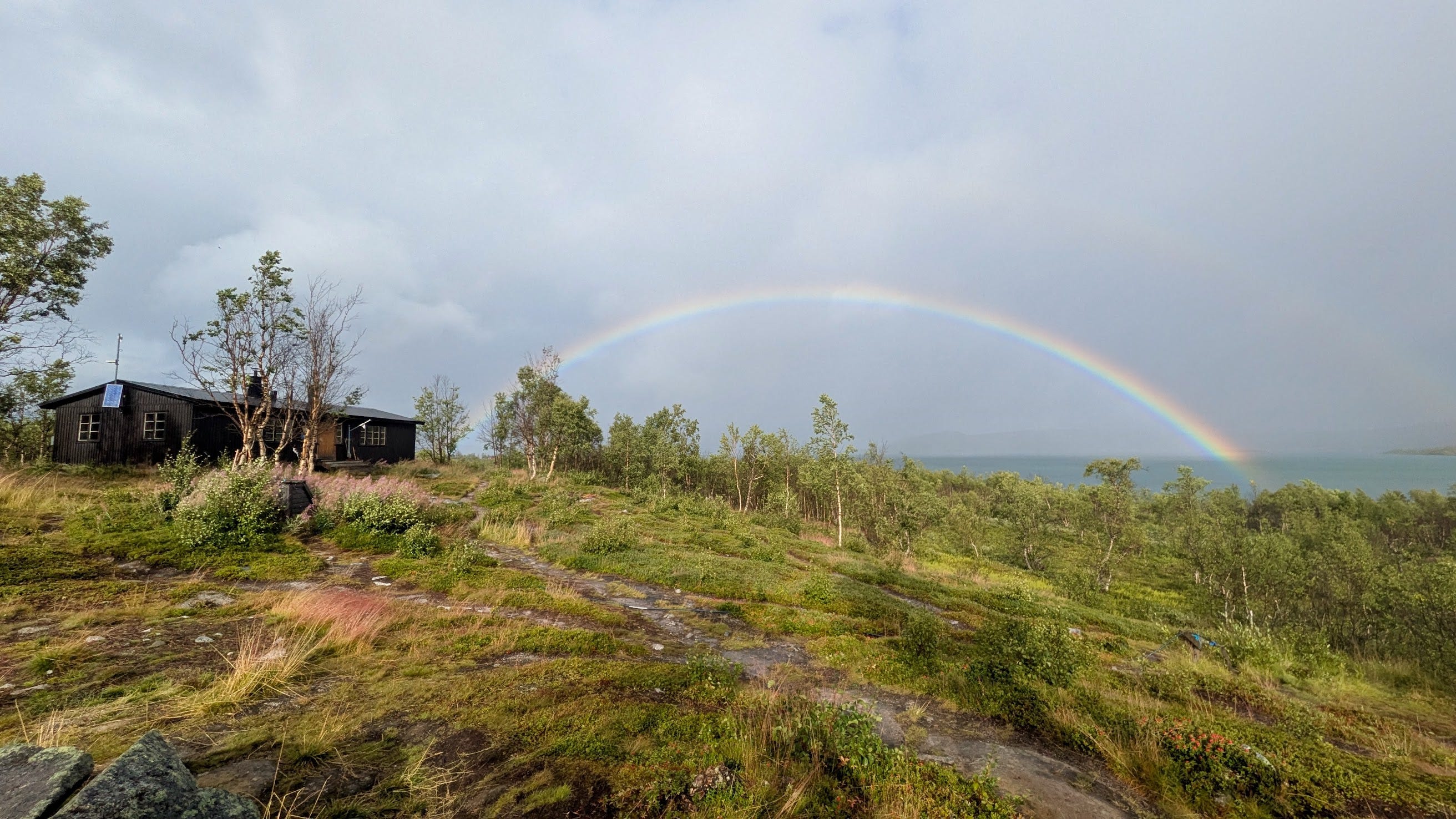
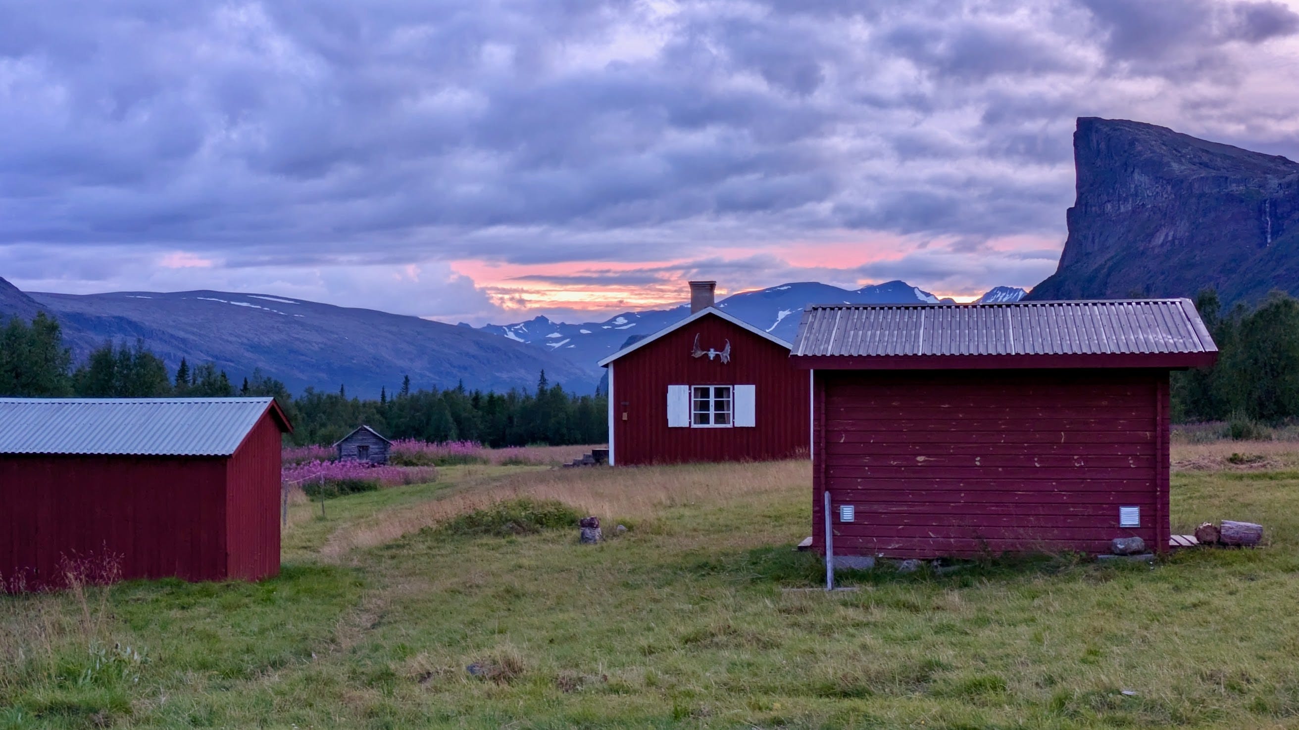
The scenery changes again, bushes and bogs, plank walks, a mighty river, bridges and finally the STF hut of Akka, we’ve made it. The hiking gods show us their approval with a double rainbow. We figure out that the boat to the other side of lake Ritsem (a lake entirely made by man for the purpose of hydroelectricity) is not going due to heavy winds. What better thing to do in heavy winds than calling a helicopter. We can’t resist and are soon after checking into the STF hut in Ritsem. The rest is warm showers, beer, terrible sausages (that are amazing) and de-proach discussions.
The next day we’d wait for the bus and walk another 6km through a cloudberry marsh around Ritsem with great views over the lake towards our recent past. My heart wouldn’t be totally in it and I’d think about how and when I might get back to the last wilderness of Europe, the magical Sarek.
Hiking as a metaphor for living and dying well
The Kebnekaise adventure in 2023 was all about the landscapes for me while being there as well as in the processing of the adventure. This time was different for reasons that aren’t clear to me. It was a lot more about the meta level or philosophy of hiking and how it feels to challenge yourself that way.
During the hike I pondered the meaning of walking in the wilderness with everything you need on your back. The simplicity of it. The clearly defined and yet intricate confrontation with just your body and the nature surrounding it. Hiking started to develop a deeper meaning for me than just being a hobby or a passion.
I realised that hiking holds powerful metaphors for living, aging and dying well, that hiking is a hard-but-patient teacher.
It is you and your body, the possibilities and limits are very personal, comparison with others is pointless. It’s always about the next step, nothing else really matters. You manage your body, you manage your pain, you take step by step and do your best to enjoy the changing scenery, fellowship, chance meetings.
The pace is always the one you can manage at that point in time.
While you walk, your perspective on the things around you changes with every step. You walk another few hundred meters and already you see everything from a surprising new angle.
Lowly, truly.